New York is a big state, and its parks are spread across many different areas.
Some sit beside the Atlantic Ocean. Others are surrounded by mountains, lakes, forests, waterfalls, or deep river gorges.
Because the state is so large, choosing a park only from a photo can lead to a lot of driving. A New York State Parks Map makes planning much easier.
You can quickly see which parks are near your starting point, which ones are close to each other, and which region fits the kind of trip you want.
New York officially lists about 180 state parks, stretching from Long Island all the way to Niagara Falls.
If this is your first time exploring the state’s parks, our guide to the best New York State Parks can help you decide which individual parks deserve a place on your trip.
This guide has a different purpose. Here, we will focus on locations, regions, nearby cities, and map-based trip planning so you can understand where everything is before you start driving.
New York State Parks Map: Quick Overview
A New York parks map may look crowded at first.
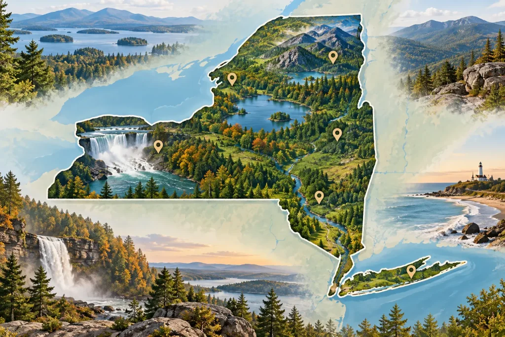
However, it becomes much easier to understand when you divide the state into regions.
The official New York State Parks system uses 11 administrative regions. State land in the Adirondacks and Catskills is mainly overseen by the New York State Department of Environmental Conservation rather than the regular State Parks agency.
For travelers, you do not need to memorize the official region numbers.
It is easier to think about areas such as Western New York, the Finger Lakes, Central New York, the Adirondacks, the Capital Region, Hudson Valley, New York City, and Long Island.
That gives you a simple picture of where parks are located.
What Does a New York State Parks Map Show?
A useful map can help you see more than just park names.
It shows how parks relate to cities, roads, lakes, rivers, and other parks.
For example, someone staying in Buffalo can focus on Niagara-area parks and western New York.
A traveler staying near Ithaca can easily explore several Finger Lakes parks without crossing the entire state.
Someone visiting New York City may prefer Bear Mountain, Harriman, Long Island, or a park inside the city.
The map helps answer a simple question:
Which parks actually make sense for my trip?
How to Use the NY Parks Map
Start with the place where you will be staying.
Next, look at the parks within a reasonable driving distance.
Then think about your main activity.
You may want waterfalls, hiking, camping, beaches, easy family walks, or scenic views.
The NY Parks Map becomes much more useful when you combine location with what you want to do.
For a day trip, choose one nearby area.
For a weekend, you may be able to combine several parks in the same region.
For current park locations and amenities, the official New York State Parks park finder lets visitors search by park name, region, county, and activity.
New York State Parks by Region at a Glance
Before looking at individual areas in detail, this quick table will help you understand the state.
| Region or Area | Useful Base | Known For |
|---|---|---|
| Niagara & Western New York | Buffalo | Niagara Falls, river gorges |
| Allegany & Southwest | Salamanca area | Forests, camping, lakes |
| Genesee | Rochester | Letchworth, waterfalls, gorges |
| Finger Lakes | Ithaca / Watkins Glen | Waterfalls, lakes, gorge trails |
| Central New York | Syracuse | Lakes, waterfalls, easy day trips |
| Thousand Islands | Watertown | River views, islands, camping |
| Adirondacks | Lake Placid area | Mountains, lakes, wilderness |
| Capital Region | Albany / Saratoga | Scenic views, lakes, history |
| Hudson Valley & Catskills | Hudson Valley towns | Hiking, mountains, fall colors |
| Palisades | NYC metro area | Day trips, hiking, lake parks |
| Long Island | Long Island / NYC | Ocean beaches, coastal scenery |
| New York City | NYC | Urban waterfront parks |
This table is useful when you are deciding which part of the state deserves most of your time.
New York State Park Regions Explained
Each part of New York offers a different type of outdoor trip.
Instead of trying to visit parks across the whole state, choose one or two nearby regions.
Niagara and Western New York
Western New York sits around Buffalo and the Canadian border.
Niagara Falls State Park is the best-known park in this area. Nearby Whirlpool State Park and Devil’s Hole State Park give visitors more views of the Niagara River gorge.
This region makes the most sense for travelers already visiting Buffalo or Niagara Falls.
It is especially good for waterfalls, river scenery, short hikes, and dramatic viewpoints.
Allegany and Southwestern New York
Southwestern New York feels much quieter.
Forests, hills, small lakes, and camping areas are common here.
Allegany State Park is the major park in the region and works well for travelers who want to stay outside for more than a few hours.
This area is a better match for camping, cabins, fishing, walking, and peaceful weekends than fast sightseeing.
Genesee and the Rochester Area
The Genesee region sits around western and west-central New York.
Letchworth State Park is the main landmark to know on the map.
The park follows the Genesee River through a large gorge with waterfalls, viewpoints, trails, and picnic areas.
It is a useful stop for travelers coming from Rochester or moving between the Buffalo area and the Finger Lakes.
Finger Lakes State Parks
The Finger Lakes region is easy to recognize because of its long, narrow lakes.
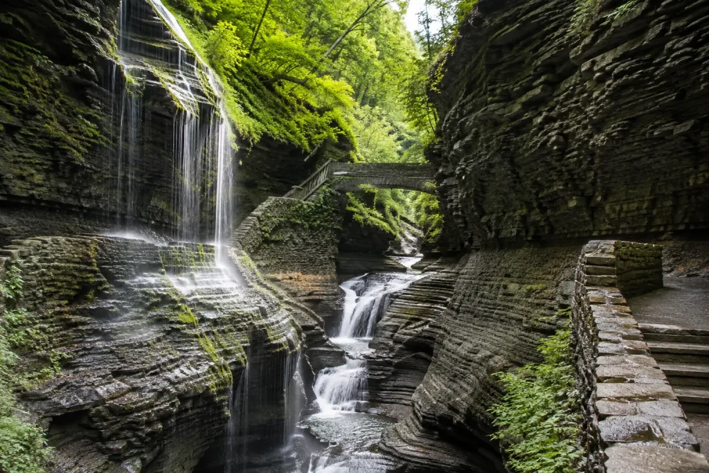
It is also one of New York’s strongest areas for gorge and waterfall parks.
Watkins Glen State Park, Taughannock Falls State Park, Robert H. Treman State Park, and Buttermilk Falls State Park are all in this wider region.
Because several popular parks are located fairly close together, the Finger Lakes work especially well for a two- or three-day road trip.
If waterfalls are your main reason for visiting, this is one of the first areas to mark on your map.
Central New York
Central New York includes Syracuse and surrounding areas.
Green Lakes State Park is a popular choice near Syracuse, while Chittenango Falls State Park gives travelers an easy waterfall stop.
Clark Reservation State Park is another nearby outdoor option.
This region is useful for shorter trips because several parks can be reached without driving deep into the mountains.
Thousand Islands and Northern New York
The Thousand Islands area follows the St. Lawrence River in northern New York.
Water is the main feature here.
Parks such as Wellesley Island State Park are popular for camping, boating, fishing, and river views.
This is a strong area for summer trips, especially if you enjoy staying beside the water.
Adirondacks and North Country
The Adirondacks cover a huge part of northern New York.
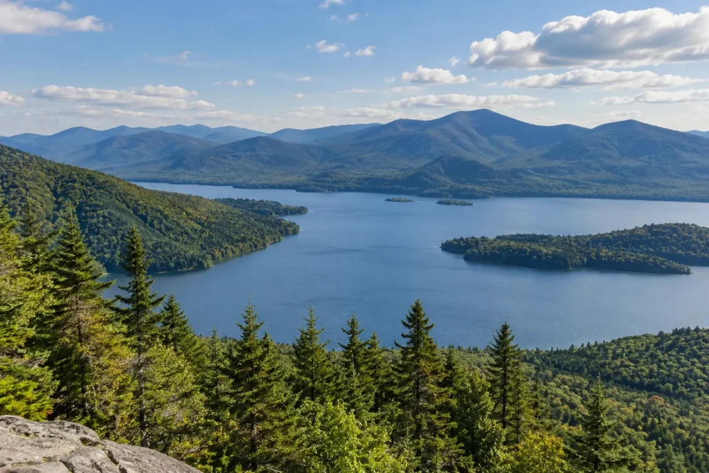
The area is known for mountains, lakes, forests, hiking, and scenic drives.
However, there is one important map detail to understand.
Much of the state-owned land inside Adirondack Park is managed by the New York State Department of Environmental Conservation rather than the regular State Parks system.
Distances are also much larger than they may look on a state map.
Instead of trying to cross the Adirondacks in one day, choose one smaller area and explore it properly.
Saratoga and the Capital Region
Albany and Saratoga Springs are useful bases for this part of the state.
Saratoga Spa State Park is close to Saratoga Springs, while Thacher State Park lies west of Albany.
Grafton Lakes State Park is another option in the wider region.
This area works well for travelers who want outdoor time without going far into northern New York.
Catskills and Hudson Valley
The Hudson Valley stretches north from the New York City area.
It includes wooded hills, river scenery, trails, viewpoints, and many easy weekend-trip options.
The Catskills sit farther west and offer more mountain scenery.
Like the Adirondacks, much of the state land inside Catskill Park is managed by the DEC.
This wider area is especially popular for hiking and fall scenery.
Palisades and Parks Near New York City
The Palisades area is important for travelers starting in New York City.
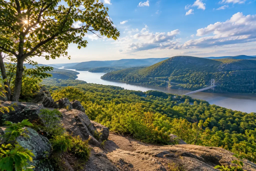
Bear Mountain State Park and Harriman State Park are two of the best-known outdoor areas north of the city.
They offer forests, trails, lakes, picnic areas, and mountain views without requiring a trip across New York State.
If your trip begins in the city, our state parks near NYC guide can help you compare nearby choices, driving times, and activities in more detail.
That dedicated guide should be your next stop if location near NYC matters more than the rest of the state.
Long Island State Parks
Long Island stretches east from New York City.
This is the part of the map to focus on when ocean beaches are your main goal.
Jones Beach State Park, Robert Moses State Park, Sunken Meadow State Park, and Montauk Point State Park are some of the better-known locations.
The region is busiest in summer, but spring and fall can also be good times for coastal walks and views.
New York City State Parks
You do not have to leave New York City to visit a state park.
Gantry Plaza State Park, Marsha P. Johnson State Park, Shirley Chisholm State Park, and Denny Farrell Riverbank State Park provide outdoor spaces inside the city.
These are very different from Adirondack mountain parks or Finger Lakes gorges.
Still, they can be useful if you have limited time or no car.
Best New York Park Regions for Different Types of Trips
Once you understand the map, the next step is matching a region to your travel style.
You do not need a long list of parks.
First choose the right area. Then choose the individual park.
Best Regions for Waterfalls
Start with the Finger Lakes, Genesee region, and Niagara area.
The Finger Lakes group several famous waterfall parks fairly close together.
The Genesee region gives you Letchworth, while western New York gives you Niagara Falls and the Niagara River gorge.
If you want exact trail choices rather than regional planning, our waterfall hikes guide goes deeper into the walking routes.
That keeps your map planning simple while helping you choose a trail later.
Best Regions for Hiking
The Adirondacks are best suited to travelers looking for mountains and longer outdoor adventures.
The Catskills and Hudson Valley are easier options for many people traveling from downstate New York.
The Palisades region is another practical choice for day hikes from NYC.
If hiking is the main goal of your trip, our best state park hiking trails guide can help you compare trail difficulty, scenery, and distance.
Best Regions for Beaches and Swimming
Long Island is the obvious place to start for ocean beaches.
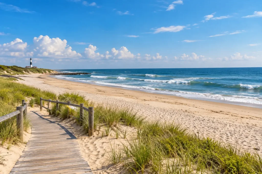
However, beach trips are not limited to the coast.
Several inland state parks have lake swimming areas during the warmer months.
Our New York State Parks with beaches guide is the better place to compare individual swimming and beach options.
For this map guide, the main point is simple: focus on Long Island for ocean trips and look toward lake regions for freshwater swimming.
Best Regions for Camping
Southwestern New York, the Finger Lakes, Thousand Islands, and northern New York are all worth checking for camping trips.
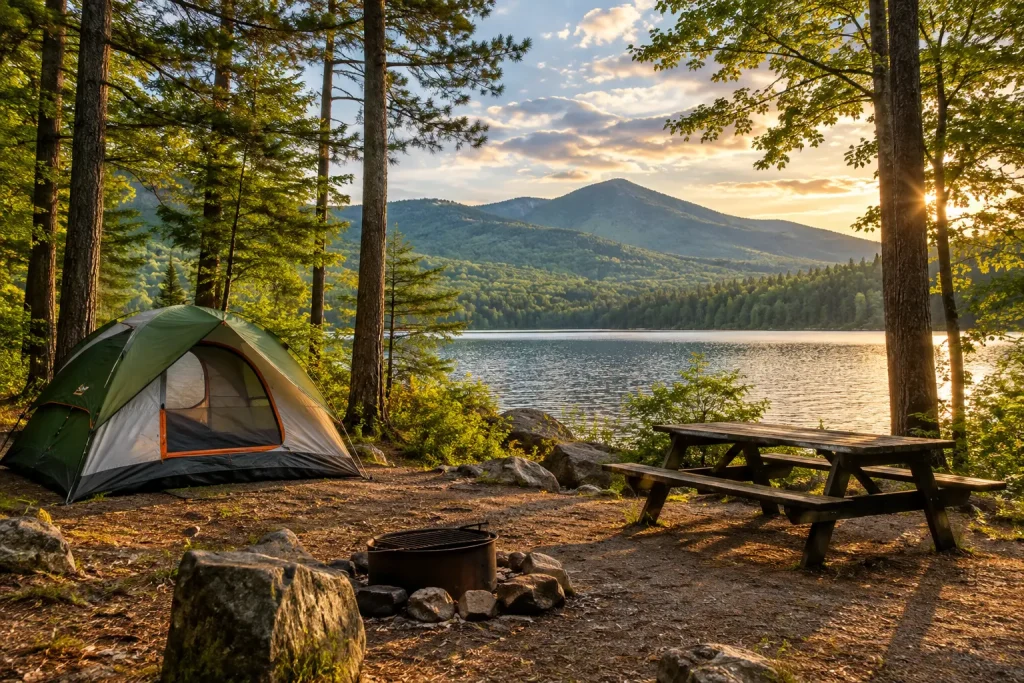
The best area depends on whether you want forests, waterfalls, river views, or mountain scenery.
For campsite choices, reservation planning, cabins, and camping details, see our New York State Park camping guide.
That article can help you choose a campground after you have selected your region.
Best Regions for Scenic Views
You can find beautiful scenery across almost every part of New York.
However, the Adirondacks, Hudson Valley, Catskills, Finger Lakes, Niagara area, and Genesee region are especially strong.
The scenery also changes with the season.
Our scenic state parks guide is useful if viewpoints and photography matter more to you than a specific activity.
State Parks Near Me: Parks Close to Major New York Cities
Many people do not want a statewide road trip.
They simply want to know which parks are close enough for a day outside.
If you are searching for State Parks Near Me, start with your nearest large city and compare actual travel time.
State Parks Near New York City
Bear Mountain and Harriman are popular choices for getting out of the city.
Long Island is better if you want an ocean beach.
You can also stay inside NYC and visit one of the city’s waterfront state parks.
For a fuller comparison, use our state parks near NYC guide rather than trying to compare every option here.
State Parks Near Buffalo
Buffalo is a useful base for Niagara-area parks.
Niagara Falls State Park is the main attraction, while Whirlpool and Devil’s Hole help visitors explore more of the river gorge.
These parks work well together because they sit in the same general part of western New York.
State Parks Near Rochester
Letchworth is one of the most popular large parks within reach of Rochester.
Hamlin Beach State Park gives you a Lake Ontario option.
Chimney Bluffs State Park lies farther east and provides a different lakeside landscape.
The best choice depends on whether you want waterfalls, a beach, or scenic walking.
State Parks Near Syracuse
Green Lakes State Park is one of the easiest parks to reach from Syracuse.
Clark Reservation State Park is another nearby option.
Chittenango Falls State Park works well if a waterfall is the main goal.
These choices make Central New York convenient for simple day trips.
State Parks Near Albany
Thacher State Park is a popular choice near Albany.
Saratoga Spa State Park makes sense if your trip includes Saratoga Springs.
Grafton Lakes State Park offers another option east of the capital.
Albany is also a useful starting point for trips north toward the Adirondacks or south toward the Hudson Valley.
Key Parks to Locate on Your New York State Parks Map
You do not need to mark every park before planning your trip.
A few well-known locations can act as reference points.
Niagara Falls State Park helps you locate western New York.
Letchworth marks the Genesee area.
Watkins Glen gives you a clear Finger Lakes reference point.
Bear Mountain helps show where many NYC day trips begin.
Jones Beach gives you a Long Island reference point.
Once these major locations are on your map, it becomes easier to understand where smaller parks fit.
For detailed recommendations about which individual destinations are most worth visiting, return to our best New York State Parks guide rather than using this map article as a park ranking.
How to Plan a New York State Parks Road Trip by Region
One of the biggest mistakes people make is choosing parks from opposite sides of the state.
A better plan is to group nearby parks.
Group Nearby Parks Together
A Finger Lakes trip might combine Watkins Glen, Taughannock Falls, Robert H. Treman, and Buttermilk Falls.
A western New York trip could focus on Buffalo, Niagara Falls, nearby gorge parks, and then Letchworth if your schedule allows.
A Hudson Valley trip can combine parks, small towns, river views, and nearby hiking areas.
This approach gives you more time outside and less time on highways.
Check Drive Time, Not Just Map Distance
Two parks may look close when the whole state is shown on one screen.
That does not mean they are a quick drive apart.
Traffic around New York City and Long Island can slow trips down.
Mountain and rural roads can also take longer than expected.
Always check estimated travel time before building your route.
Know When to Stay Overnight
An overnight stay often makes sense when a park is several hours from your starting point. If you plan multiple park visits during your trip, check whether the New York Empire Pass could reduce your admission costs.
It also gives you more time for longer hikes, camping, sunrise or sunset, and nearby parks.
Instead of trying to fit four distant places into one day, choose a smaller area and enjoy it properly.
How to Find the Closest State Park
You do not need to search through every New York park one by one.
Start with your location.
Then narrow the results by region, county, distance, or activity.
Search by Region or County
If you know the county or general area where you are staying, use that first.
This makes it much easier to find parks that actually fit your route.
You can then compare nearby choices based on hiking, beaches, waterfalls, camping, boating, or other activities.
Use the New York State Parks Explorer App
The official Explorer app can search parks and historic sites by location or amenities and sort results by distance.
It also includes directions, hours, fees, maps, alerts, and other trip information.
You can learn more through the New York State Parks Explorer App.
It is especially useful when your search starts with a simple question such as, “Which state park is closest to me?”
Save Maps Before Remote Trips
Do not assume you will have a strong mobile signal everywhere.
Remote mountain and forest areas may have weak service.
The Explorer app includes offline mapping tools for places where connectivity may be limited.
Saving your map before leaving can make a remote trip much easier.
Tips for Using a New York State Parks Map Before Your Visit
A map is a starting point, not the whole trip plan.
Before leaving, check current park details. Before visiting, also review the New York State Park rules for pets, swimming, camping, and other activities.
Look at the route and travel time again.
Make sure the trail, beach, campground, or activity you want is available on the day of your visit.
Seasonal conditions can change. If you are planning your visit around weather, crowds, or seasonal activities, our guide on the best time to visit New York State Parks explains what to expect in every season.
For example, swimming areas, campgrounds, visitor buildings, and some trails may not operate all year.
It is also smart to check parking information before visiting popular parks on summer weekends or during peak fall color.
Planning these small details ahead of time can save you from a disappointing trip.
New York State Parks Map FAQs
How Many State Parks Are There in New York?
New York State Parks currently lists about 180 state parks.
You may see larger numbers because the wider system also includes historic sites, recreational trails, golf courses, boat launches, and other properties.
What Is the Best Region for New York State Parks?
There is no single best region for everyone.
The Finger Lakes are great for waterfalls.
Long Island is the main choice for ocean beaches.
The Adirondacks and Catskills are better for mountain scenery.
Western New York is useful for Niagara Falls, while the Hudson Valley works well for many trips from NYC.
Choose the region that matches your activity and starting point.
What Are the Best State Parks Near New York City?
Bear Mountain and Harriman are two popular choices north of the city.
Long Island also gives NYC travelers access to beach parks.
Inside the city, you can find smaller waterfront state parks.
For a deeper comparison, see our state parks near NYC guide.
Which New York State Parks Are Near Niagara Falls?
Niagara Falls State Park is the main park in the area.
Whirlpool State Park and Devil’s Hole State Park are also close to the Niagara River.
Because these locations are in the same general area, they can fit into one Niagara-focused trip.
Which New York State Parks Are in the Finger Lakes?
Some of the best-known Finger Lakes parks include Watkins Glen, Taughannock Falls, Robert H. Treman, and Buttermilk Falls.
They are especially useful for travelers building a waterfall or gorge-focused road trip.
Which Part of New York Is Best for Camping?
It depends on the scenery you want.
Southwestern New York is good for forest camping, the Thousand Islands offer river scenery, the Finger Lakes combine camping with waterfalls, and northern New York gives you more remote outdoor settings.
Our New York State Park camping guide covers individual camping choices in more detail.
Where Can I Find Waterfall Hikes in New York State Parks?
The Finger Lakes and Genesee regions are two of the best places to start.
Western New York also has dramatic waterfall and gorge scenery around Niagara.
For individual routes rather than map planning, use our waterfall hikes guide.
How Can I Find State Parks Near Me in New York?
Start with your current city or county.
Then use a park map or location search to compare nearby parks.
Check driving time, activities, hours, and seasonal access before choosing.
The closest park is not always the best choice. Sometimes a slightly longer drive gives you the experience you actually want.
Final Thoughts: Use the New York State Parks Map to Plan Smarter
New York has state parks from the Atlantic coast to the Niagara River.
That variety is exciting, but it also means good planning matters.
A New York State Parks Map helps you understand which regions are close to you and which parks can be grouped into the same trip.
Start with your location.
Choose the region that matches your interests.
Then compare nearby parks instead of trying to cross the whole state.
If you want waterfalls, look toward the Finger Lakes, Genesee region, and Niagara area.
If beaches are more important, focus on Long Island.
For mountains, look toward the Adirondacks, Catskills, and Hudson Valley.
Most importantly, do not try to see every park on one trip.
Choose one area, give yourself enough time to enjoy it, and save another part of New York for your next adventure.

Silas Harlow
Silas Harlow is a travel writer and budget travel researcher at TravelBee Trips. He creates practical guides covering destinations, accommodation, transportation, attractions, safety, and affordable travel planning. His research uses official tourism resources, government websites, maps, and established service providers where available. Because travel information changes frequently, readers should verify important details before booking. View his complete author profile and editorial approach.